Showing posts with label hiking. Show all posts

Monday, May 10, 2010

The Great Escape


Now that we are free from weekend runs that impact half of our Saturday and necessitate a full Sunday recovery, Zdenek and I are trying to take advantage of our new found freedom by fitting in bike rides and weight training sessions whenever we feel like it. I thought it would be a good idea for us to also get out of the city a bit more and explore some of the lovely Northeastern surroundings that lie within an hour or two by train or automobile, and so we decided to head to Bear Mountain on Sunday with my good friend, Caitlin.

I had a whole blog entry written about this 11 mile (asinine) adventure, but on second thought, I've decided not to post it. Caitlin and Zdenek will understand why. The rest of you will have to be content with some photos.

View of the Hudson

New York City skyline from 50+ miles away

On the Major Welch Trail

Hiking up 12,000 year-old ice-age boulders
(or, as Caitlin sarcastically declared, the grandeur of the Northeast)


No bears, only hikers

Me: tired and cold

They carried the backpacks; I carried the camera

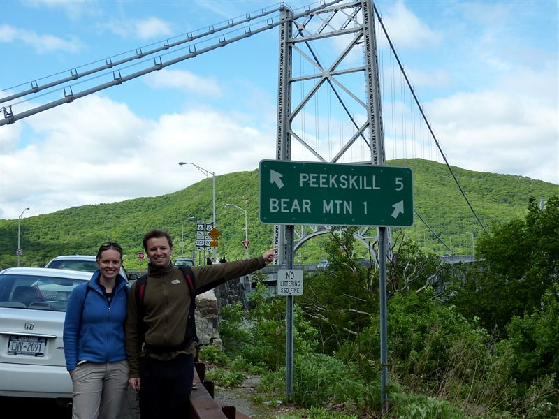
View from the Bear Mountain suspension bridge, overlooking Iona Island

Sunday, November 1, 2009

RMNP - Storm Pass and Lily Ridge Trail

It’s already November and today was the first day that I was able to leave the house for an extended amount of time in weeks. For the last 3 weeks I’ve been mostly bed-ridden with the N1H1 flu bug. In all my life, I have never been this sick and for such a long period of time. Unlike the regular flu, the swine flu is particularly nasty and long.

Unfortunately, I was still pretty weak today so I didn’t know how far I would be able to hike, but I was excited to be able to get out in to the mountains. We’ve had more snow and I wanted to see the mountains snow covered, that’s the way I like them the best.


Storm Pass Trailhead at Lily Lake off highway 7 in Estes Park

I decided to drive up to Estes Park and hike the Lily Ridge Trail, next to Lily Lake off of highway 7. It's part of the Rocky Mountain National Park but there is no entry fee. But that's not why I came here, I have a national parks pass that is still good until June 2010. I picked this place because if I really felt too weak to climb the ridge at Lily Lake I could just hike around the lake itself or just sit at one of the picnic tables. Lily Lake was easier to get to than the RMNP, and way less crowded.

When I got to the trailhead I remembered that the Storm Pass trail started at the Lily Lake also and l had wanted to hike that one for a while. This was a much longer hike than the Lily Ridge and I knew I wouldn’t make it to the pass itself and back, but I just wanted to see a bit of the trail.


Lots of snow on the Storm Pass Trail

I knew there would be a bit of snow up here and I brought my gaiters with me, but I didn’t bring my snowshoes and I should have. The snow was pretty deep and hiking it was an extra workout I didn't need today. I didn’t make it very far on the Storm Pass trail. For one, no one had hiked it since it had snowed and at times where the trail ran through an open area or dense trees, I just couldn't stay on the trail. There were trail markings, but far apart.

A few times I hiked out of the way in really deep snow to find the trail again. By the time I made it to the bridge where the trail started to climb I was thinking if hiking this trail was a good idea today. I was afraid that I would get a few miles out and then get really tired and not be able to make the hike back to the car. After lying in bed for three weeks, this hike might be been too much. I hiked about a quarter a mile past the bridge and turned around.


Pretty scenery along Storm Pass Trail

When I made it back to the trailhead I really wasn't ready to go home yet, so I decided to hike the Lily Ridge trail. Thes snow wasn’t very deep on this trail and I was able to follow foot steps in the snow the whole time. I really enjoyed both of the hikes, and by the time I made it to my car I was pretty exhausted. I probably hiked 4-5 miles total today.


Storm Pass Trail


Storm Pass Trail


Storm Pass Trail


Storm Pass Trail


Storm Pass Trail


Neat bridge on Storm Pass Trail


Lily Ridge Trail


Climbing Lily Ridge Trail


Lily Lake below Lily Ridge Trail


Lily Lake


A self-photo on top of the Lily Ridge Trail


Pretty cool view from the Lily Ridge Trail


Sunday, July 26, 2009

Lily Mountain Summit 9,786'

It’s the middle of summer but between motorcycle riding and maintenance, there just doesn’t seem to be enough time to get a good hike in. With the tires on the ST3 all warn out, the tires on the 954RR pretty much gone too and having just done a dirt ride, today was definitely a good day to go hiking.


The beginning of the Lily Mountain Trail


Looking down at highway 7 (left), near the summit a sign for the trail (right)


The trail, this is still close to the trailhead

Since I haven’t hiked much lately I wanted to do an easy hike. I especially like hiking to the top of mountains, because of all the amazing views at the top. Lily Mountain Trail was a short trail that climbed to the top of a small mountain by Colorado standards - it was perfect!


I think that is the Fish Creek Road down there


Some cool dirt road with many switch backs


Getting closer to the summit now


A neat rock formation

According to the internet the trail is just 1.7 miles from the trailhead to the summit of Lily Mountain. According to the sign at the trailhead, it is 2 miles. The Lily Mountain trailhead is located along highway 7 just south of Estes Park. The trailhead doesn’t have a parking lot, parking is allowed on the side of the road.


The trail got rocky at times (left), the scramble to the summit (right)


On top of Lily Mountain


This rock is pretty much most of the summit


Great scenery from the top of Lily Mountain

The beginning of the trail travels up and down. The last mile is a steady climb and to reach the summit requires a bit of scrambling over some large rocks. I haven’t been to the top of too many summits, but this one so far was the smallest summit - area wise.

I hung out on top for a bit, just taking in the scenery and enjoying the sunshine. It was a beautiful afternoon, with no clouds, no threat of lightening. The hike down was a lot quicker than the hike up.


The trailhead for Lily Mountain is just north of Lily Lake Trailhead


Lily Mountain Trail

Difficulty: easy/intermediate

Total miles: 4

Summit elevation: 9,786 feet

Trailhead elevation: 8,780 feet

Net elevation gain: 1,006 feet

Wednesday, June 24, 2009

Bryce Canyon N.P. - Fairyland Loop Trail


We woke up to overcast skies. Packed the bikes up with all the things we’d need for the showers when they opened at 8AM and rode over to Sunrise Point where we parked the bikes and started our hike on the Fairyland Loop Trail.


Sunrise at Sunrise Point


Rain in the distance at Sunrise Point


Hiking the Fairyland Loop Trail

The Fairyland Loop Trail is not as popular as the other trails at the park and since it was very early in the morning still we had the place all to ourselves. This trail is 8 miles long and considered strenuous. We didn’t have the time to do the entire loop, we were only going to hike to Tower Bridge and back, approximately 3 miles.


Views from the Fairyland Loop Trail


Tower Bridge


Dark rain clouds move in as we hike back to Sunrise Point


This picture and the ones below it I grabbed from Dalton's camera